Survey-grade scanning
Delivers The most accurate results.
But requires
- Expensive equipment
- A trained crew
- A site visit
We reconstruct real places from ordinary video, imagery, satellite data and LiDAR, then answer practical questions on top of them.
Loading the scan · 0%Drag the scan to orbitTwo fingers to rotate
Capture
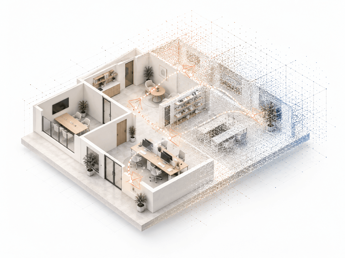
This office was captured in one unstructured walk with an ordinary phone. No LiDAR, no capture procedure, no special hardware. The amber line is the path the camera took, recovered from the video itself.
Reconstruct
We work out where every pixel sits in space and fuse the frames into one reconstruction, to scale. The room you walked through is now something you can view, and measure, from any angle.
For exteriors we gather the available satellite imagery, drone data and public LiDAR for you.
Understand
Every point carries a label, so you ask for objects by name instead of tracing them by hand. Pick one and the rest of the room steps back.
Structure
A point cloud is only the beginning. Our neural geometry system recovers the structure as boundary geometry (faces, edges and vertices), the representation CAD, estimating and simulation tools already consume.
Walls are solved where they are and heights per surface, so angled, sloped and curved geometry survives. No hand-tuned fitting rules per scene.
Measure
The model is to scale, so lengths, areas and quantities come straight off it. Pick a room on the plan or in the model.
Quantities flow into itemized repair estimates with location-specific pricing, using BNI Costbooks as the cost data source.
Ask
Build the model once and every workflow that follows runs on it. No manual remodelling between questions.
The problem
Every claim, repair, recovery grant, resiliency study and risk decision begins with a site measurement, but measuring well still involves trade-offs.
Delivers The most accurate results.
But requires
Delivers Rooms captured in minutes.
But often
These tools struggle most with it.
What it looks like
It either goes to a modeler or goes unused, leaving decisions to be made from photos and tape measurements.
The office reconstructed above is that kind of footage: one unstructured walk with an ordinary phone, no capture protocol, specialized hardware or training.
Progress
Geometry from noise
The neural reconstruction system produces clean boundary geometry from point clouds of different origins without scene-specific fitting rules.
Field to estimate
A working iOS prototype converts field photographs and video into an itemized, location-priced repair estimate.
Insurance and risk
In August 2026, Justmagic signed a cooperation agreement with Athenium, an insurance and risk analytics company.
Industries
Property measurement, construction estimating, insurance, disaster management, infrastructure and defense already pay separately for capture, measurement, simulation and cost analysis. Our core technology can connect those functions.
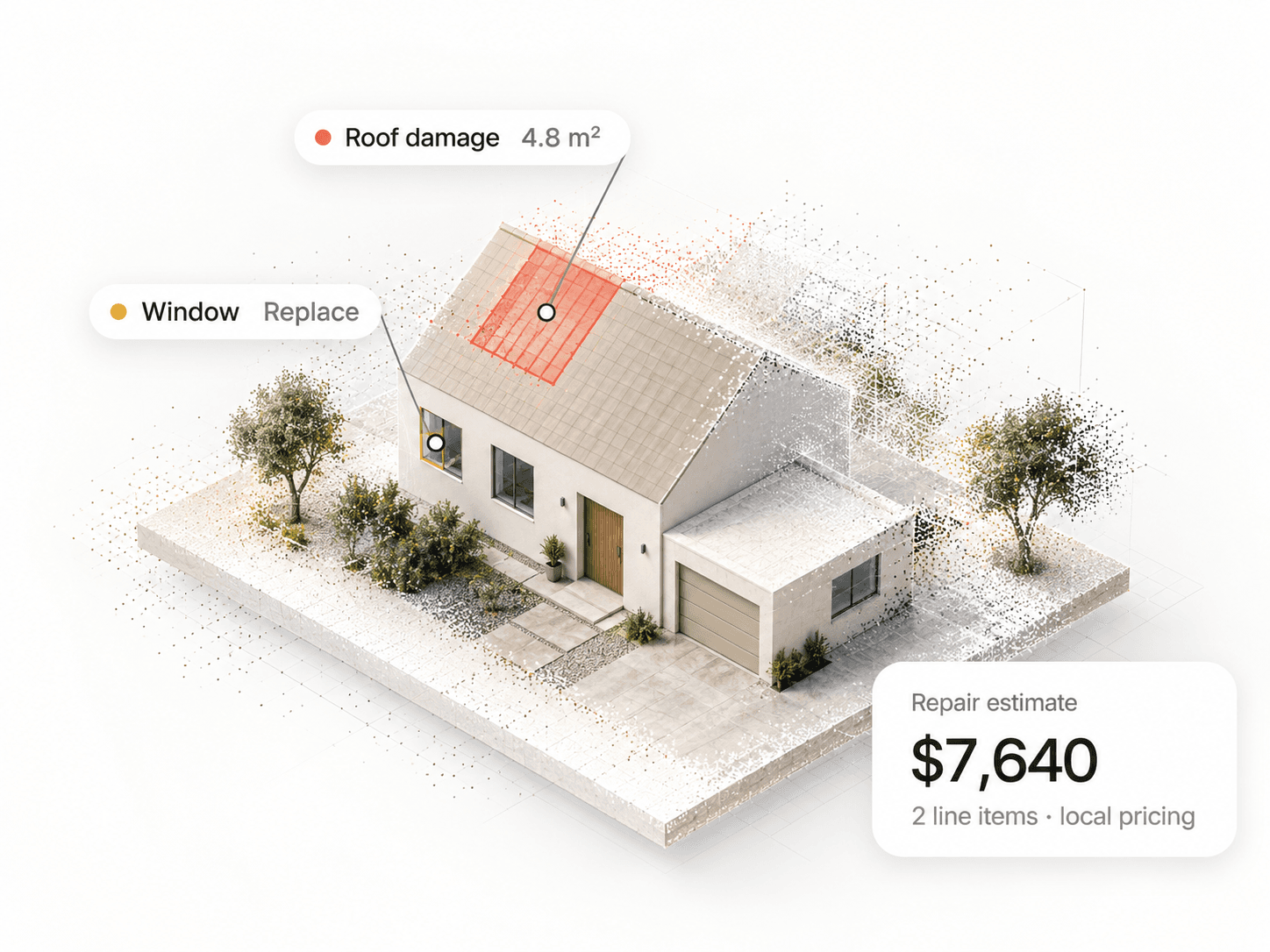
Roughly five million U.S. homeowners claims are filed each year, averaging about $17,000 each. Every one starts with what exists, what was damaged, how much of it there is and what it costs to repair. We turn the evidence collected during the claim into that structured understanding.
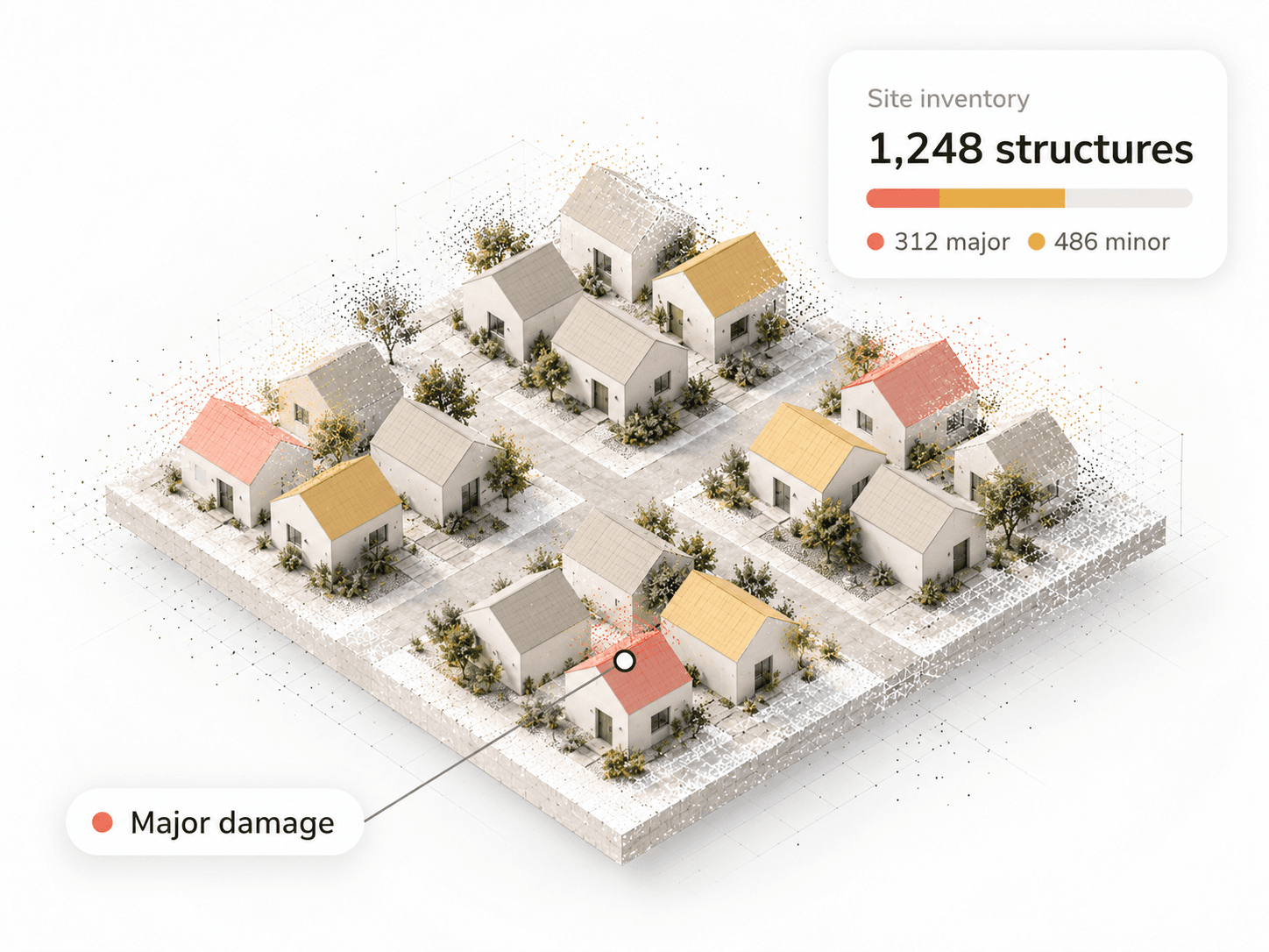
Large-scale recovery programs need inspection, damage assessment, measurement and technical analysis across thousands of properties, with site inspection and field services in scope. We reconstruct sites from evidence that already exists and apply the same measurement and analysis stack across all of them.
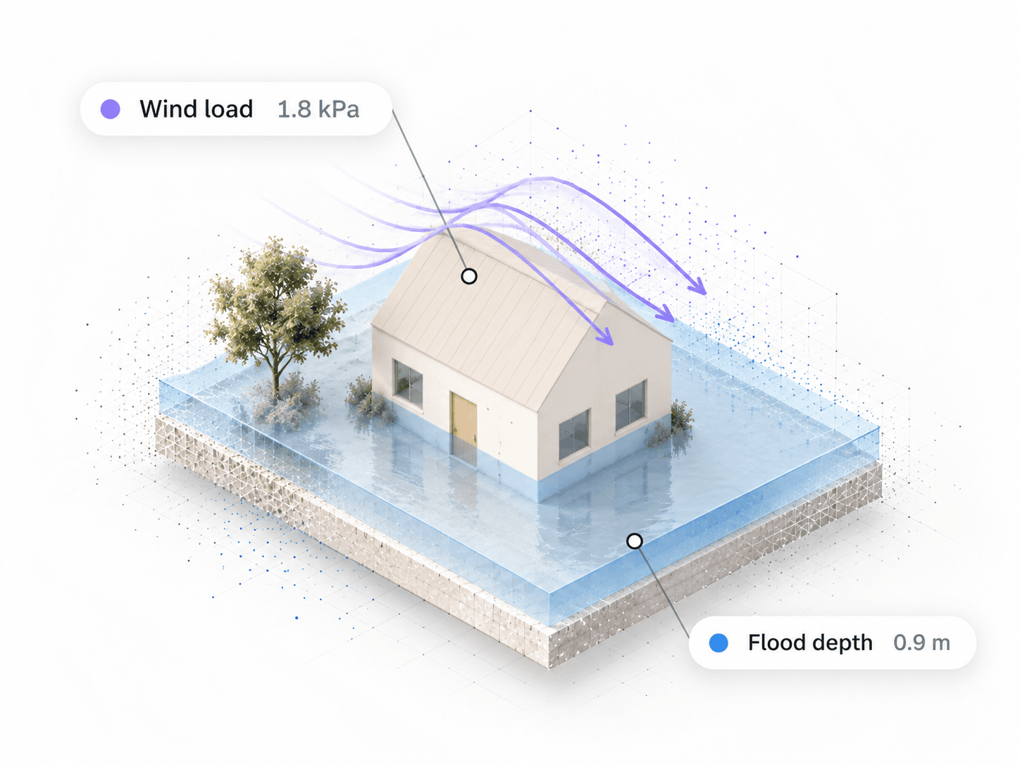
Catastrophe models begin at the hazard footprint. We extend the analysis down to the site itself: flood depth around a particular structure, wind load on a particular roof, blast pressure on a particular wall.
Paid for separately today
Potential customers and integration partners
Applications
The office above shows the technology. Each application runs it on a different kind of place, from the footage that place already has.
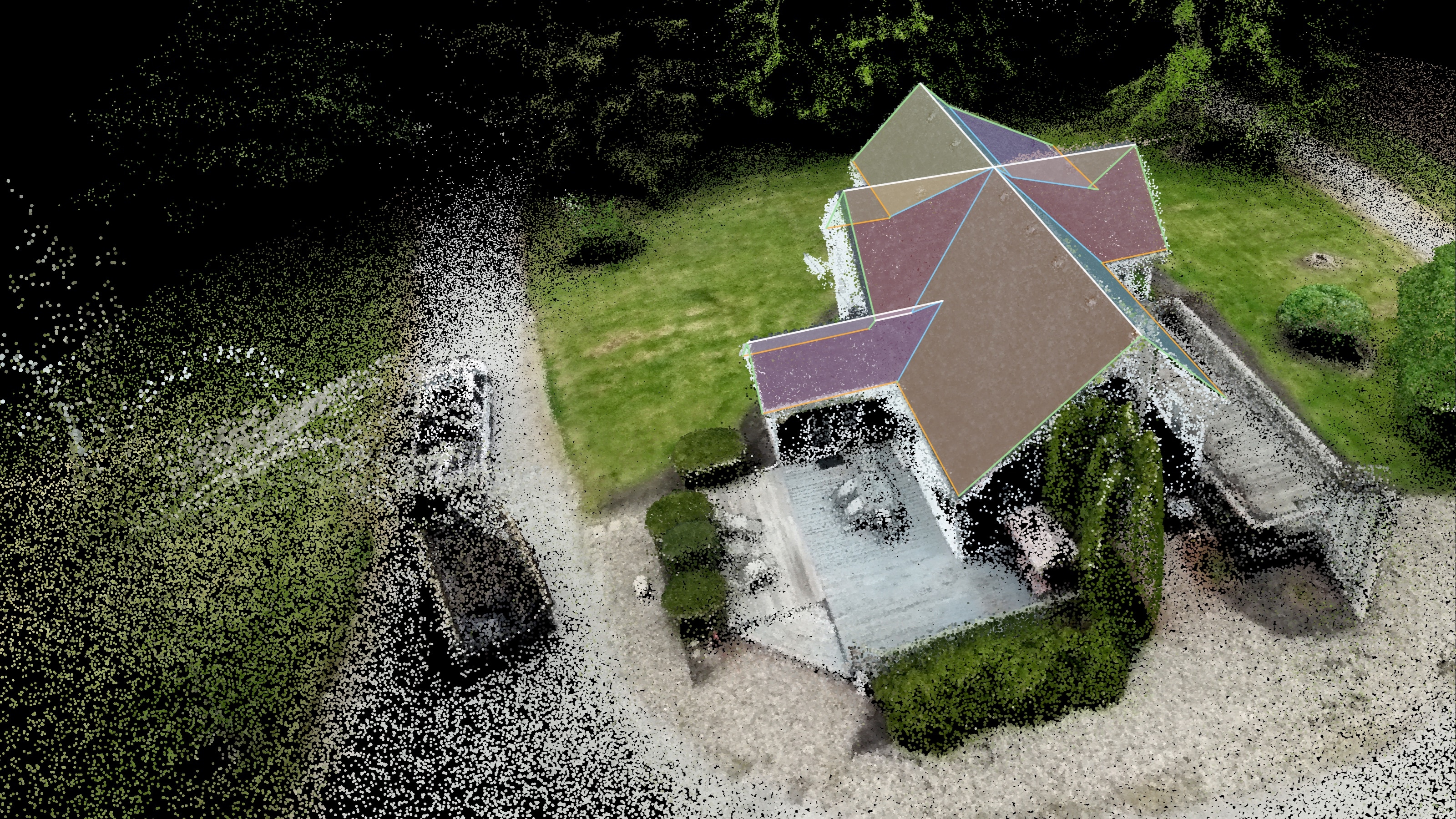
Exteriors and roofs
We reconstruct the house from ordinary imagery, find the roof and solve every facet as a plane, ready for the estimate.
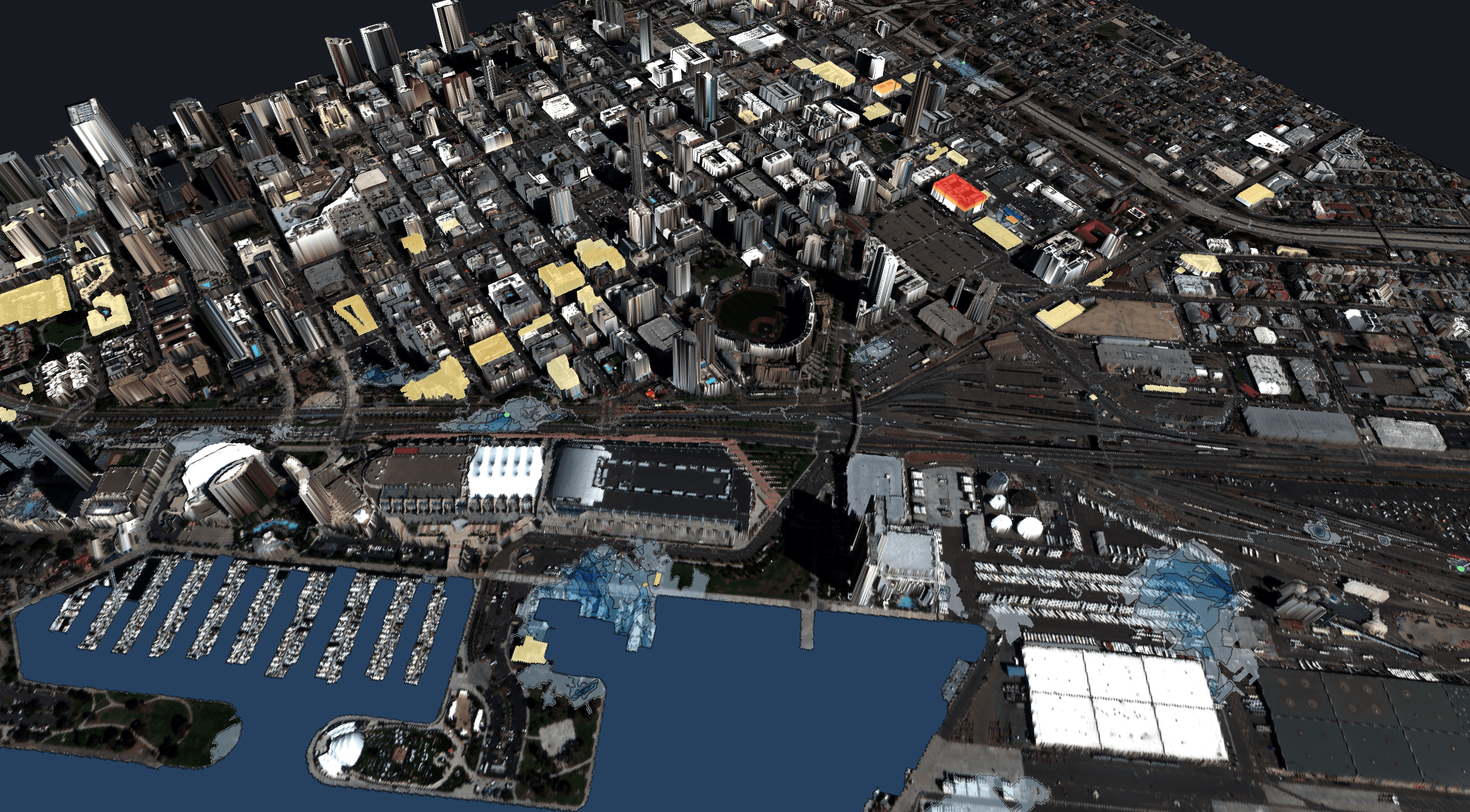
Floods
We reconstruct a city from the footage that already exists and play the storm forward over it, for rescue triage and recovery cost estimates.
Origin
san juan, puerto rico · 18.47° n · 66.11° w · est. 2023
Justmagic LLC was founded in San Juan, Puerto Rico in 2023, out of the recovery from Hurricane Maria — where measurement, recovery and risk were not abstractions.
We create a version of the real world on a computer, so the decisions that depend on it can be made faster and more precisely.
CEO
Spatial statistics.
Delivered $16 billion in recovery funds for Puerto Rico after Hurricane Maria through stratified statistical sampling and LiDAR feature extraction; modeled Hurricane Harvey flooding for Houston.
CTO
Computational mathematician and AI researcher specializing in robotic vision.
Built the neural network that recovers clean geometry from noisy scans.
Answers
Phone video, drone video, photographs, archival footage, LiDAR or point clouds, satellite imagery, existing scans in most common formats — or simply an address. Describe the area you care about in plain language.
No. There is no prescribed capture sequence, specialized camera or training workflow. Slower movement and more overlap give a denser reconstruction, but a phone without LiDAR is enough to start.
One reusable model with three views of the place: a structured scene, with walls, windows, doors, roofs, floors and damage identified automatically; CAD-ready geometry, with point clouds converted into clean faces, edges and vertices for CAD and simulation; and a visual model, with detailed interiors and photorealistic walkthroughs.
No. Our AI agents assemble the right pipeline from our proprietary reconstruction and simulation tools, hiding the complexity from the user. There are no hand-tuned fitting rules or scene-specific adjustments.
Walls, roofs, floors, openings and damaged regions recovered as clean boundary geometry — faces, edges and vertices — rather than a cloud of sampled points. It is the representation CAD, estimating and simulation systems already consume.
Yes. The model carries metric scale, so areas, spans and volumes are measured off it directly rather than inferred.
It is the shortcut of assuming every wall meets at ninety degrees and every floor and ceiling is flat and level. It makes reconstruction much easier — and it makes the quantities wrong the moment a building has an angled wall, a sloped ceiling, or a curve. We do not make it.
Yes. For exteriors we assemble drone and phone video, photographs, satellite imagery and aerial LiDAR — or start from an address — and solve the roof facet by facet: pitch, area, ridges, valleys, eaves and rakes. See the exterior walkthrough.
Measurements and quantities, damage identification, itemized locally priced repair estimates, CAD-ready geometry and photorealistic walkthroughs. One capture, one model, any number of questions.
With location-specific pricing. We use BNI Costbooks as our primary cost data source and apply regional cost factors for the site's location.
Get started
We make them computable. Bring us a video, a scan, an archive — or an address.